乌兹根(Uzgen)遗址
郁城 : 汉代城名。古西域大宛国都城。故址在今吉尔吉斯斯坦境内锡尔河上游,奥什城东北之乌兹根城。
乌兹根位于费尔干纳盆地的东部,古代大宛东部的中心。公元十世纪末,短暂作为喀喇汗汗国西半部的都城,西辽时期则是其国库所在,在蒙古西征和帖木儿时期也有着重要的地位。根据中世纪的文献记载,乌兹根是穆斯林和游牧民(尚未皈依的异教徒)的分界线。
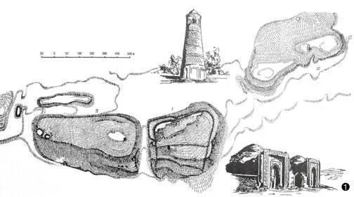
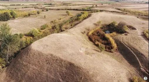
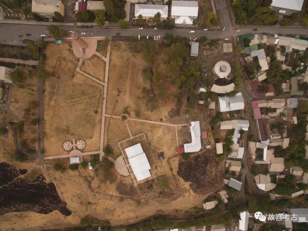
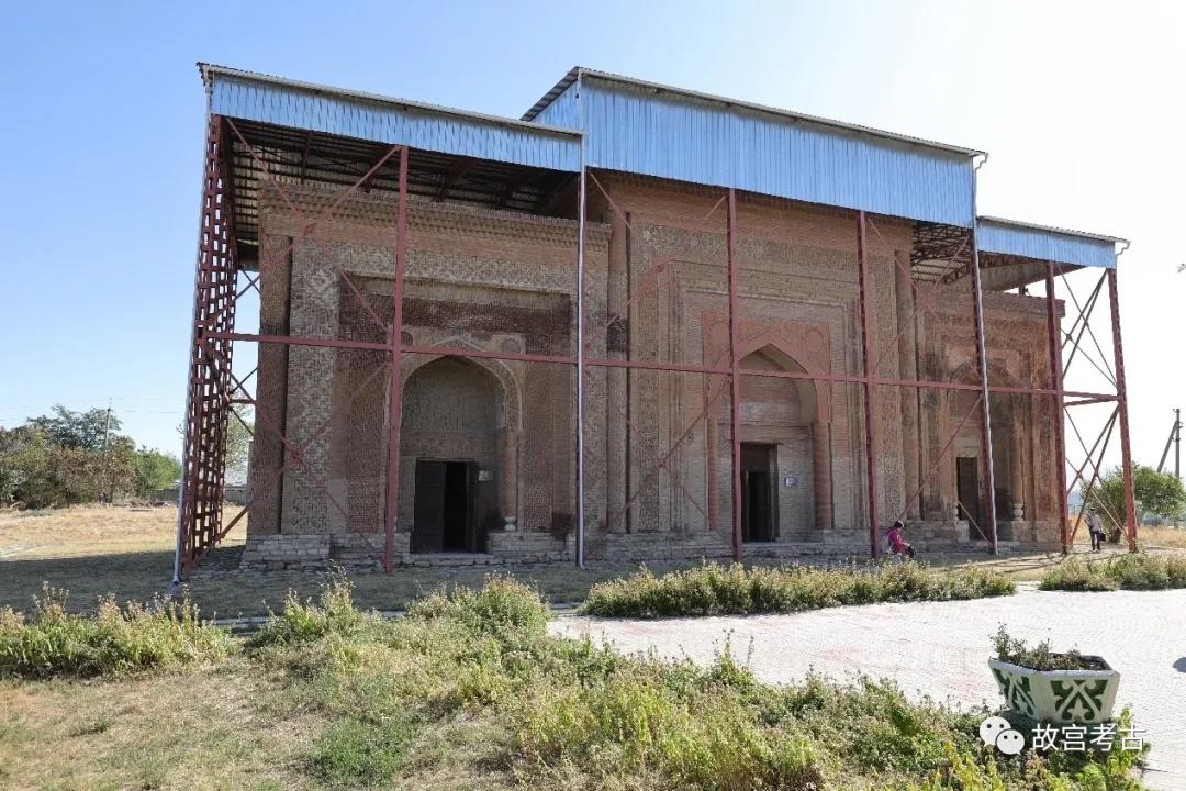
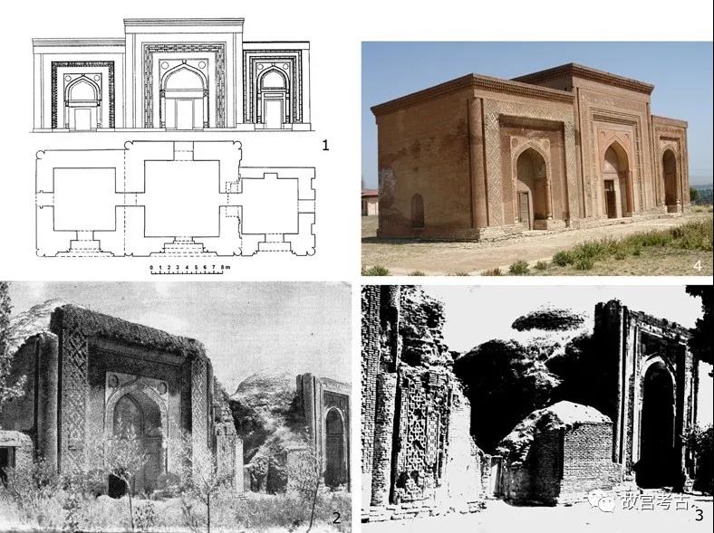
乌兹根(Uzgen)遗址位于乌兹根市中心偏南,黑河(Karadarya)河的北岸台地上,北纬40°46'7.61",东经73°17'53.61"(图二十五)。城址由I—IV号四处高台区域组成(图二十六)。其中第三座高台上的城址修筑了坚实的防御工事,起着城堡的作用,现存的宣礼塔和三座陵园位于第四座高台上,为喀喇汗汗国时期所建筑(图二十七、二十八)。乌兹根遗址把守着亚西(Yassy)河河谷的入口,通过这里进入天山的古代丝路,向北通往伊塞克湖南岸,向东通往喀什。作为丝路上重要连接点,从古到今,这里都是政治、经济、贸易和文化的交汇处(图二十九)。

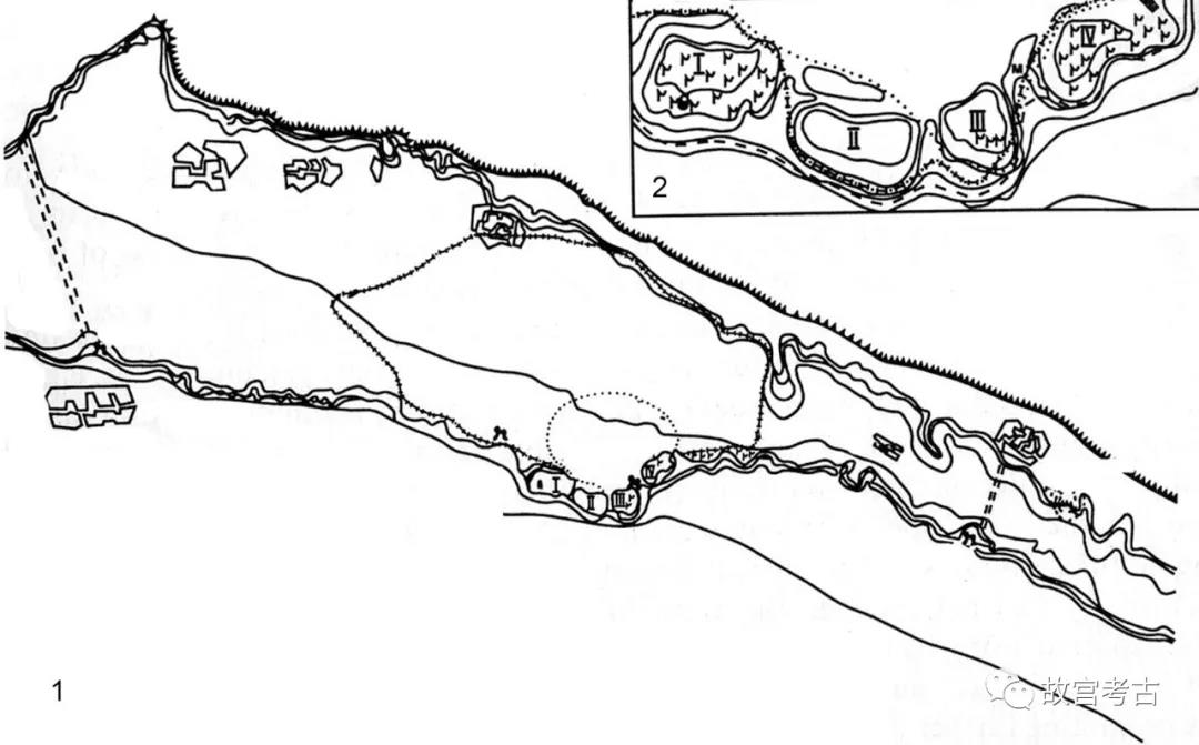
图二十五 乌兹根遗址卫星图
图二十六 乌兹根遗址平面图

图二十七 乌兹根遗址IV号区卫星图
图二十八 乌兹根宣礼塔、陵墓航拍
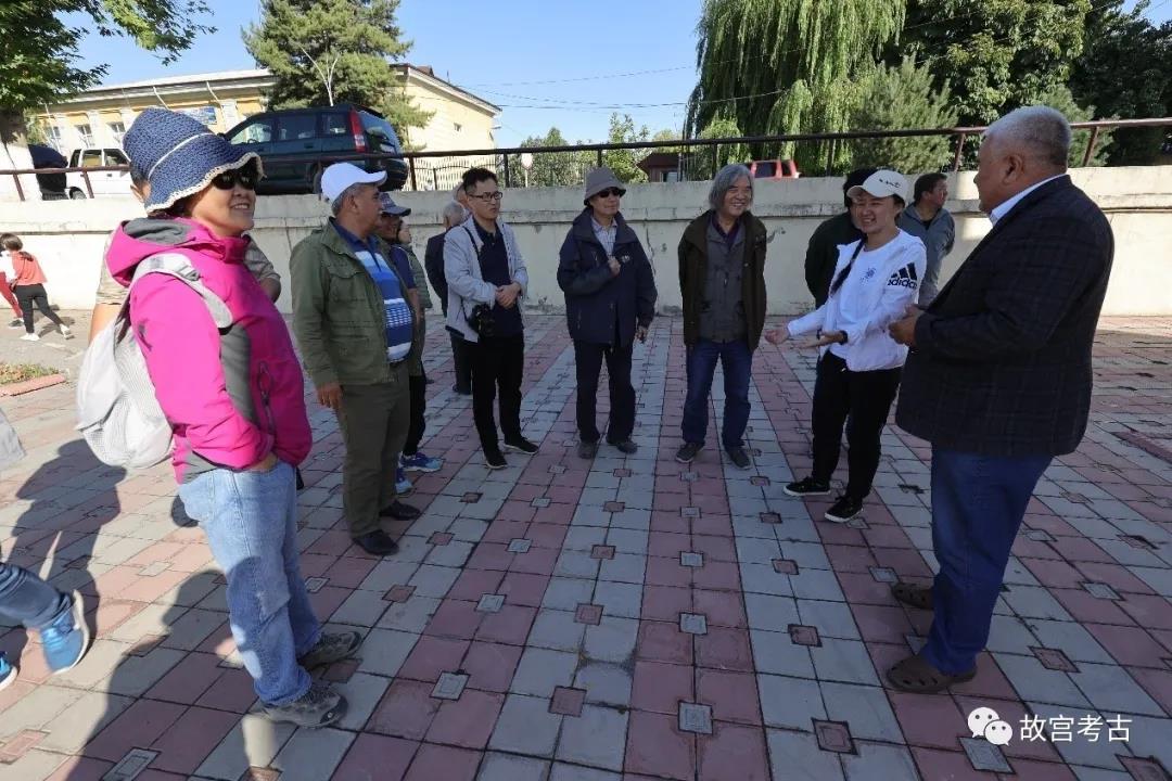
图二十九 现场参观
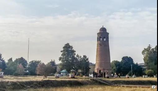
宣礼塔高24米,直径19米,与布拉纳的宣礼塔是仅存的两座喀喇汗汗国时期的宣礼塔,该塔的八面体塔基、塔的圆顶和塔身的砖雕十分繁复(图三十)。

图三十 乌兹根宣礼塔
1988—1989年的考古发掘发现了在宣礼塔和陵墓之间曾经有过一座大型建筑,可能是13世纪的经学院遗址(图三十一)。
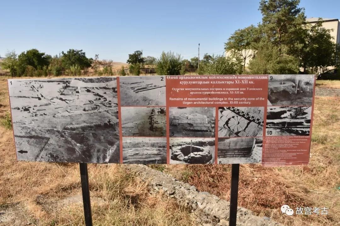
图三十一 发掘现场遗迹介绍
陵墓由三座砖砌建筑构成,最早的一座建于11世纪,上世纪20年代和70、80年代经过发掘和修复,通过其中的铭文了解到喀喇汗汗国在乌兹根的首领和军队领导也被葬在北部和南部的两座墓室中,他们生活在大约12世纪的中期(图三十二-三十五)。
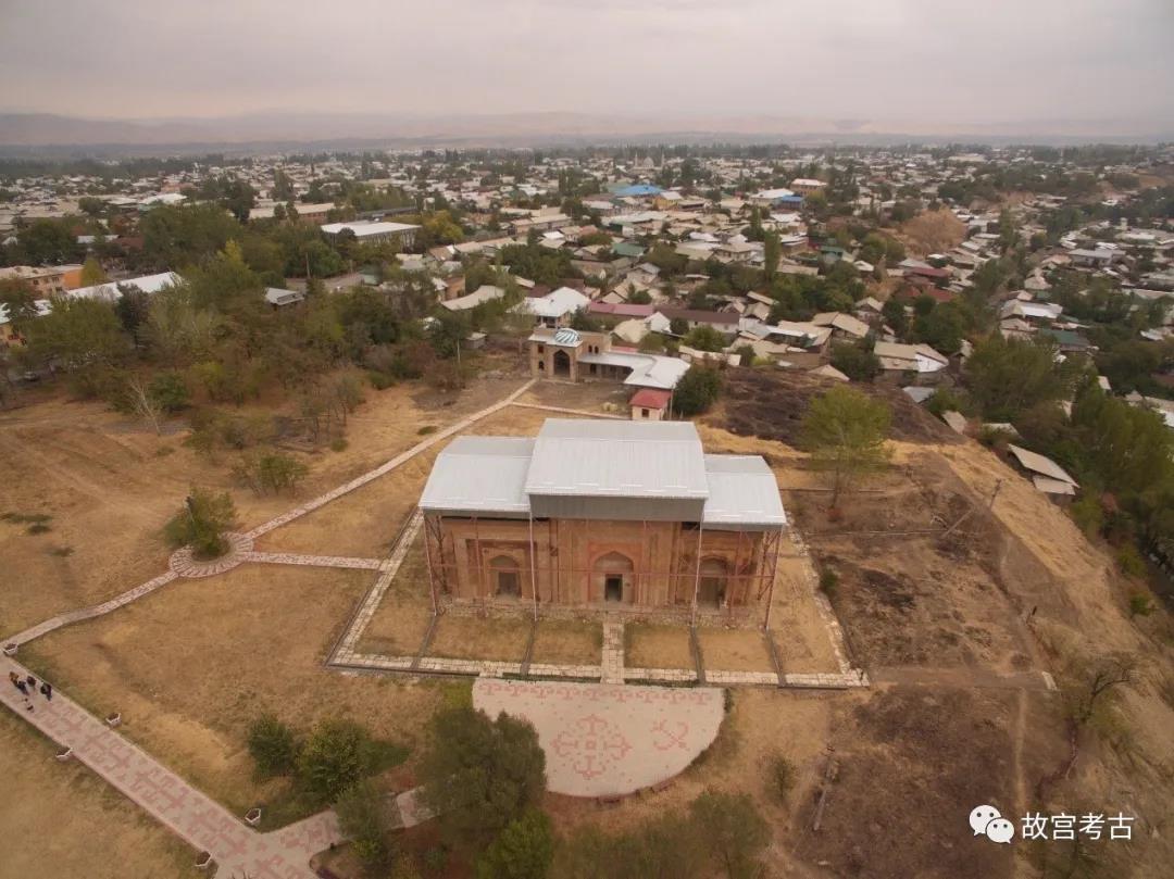
图三十二 乌兹根遗址陵墓航拍
图三十三 陵墓与保护大棚
图三十四 陵墓保护前旧照
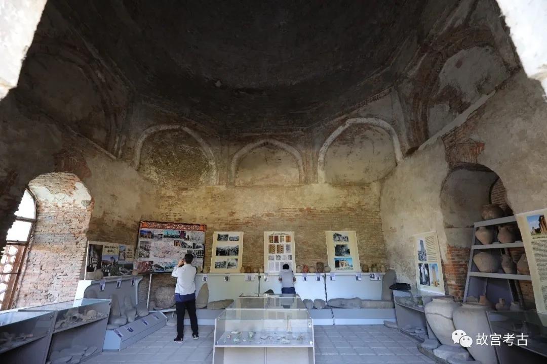
图三十五 陵墓内设置的小型陈列室
外墙有传统伊斯兰风格称为库菲(Kufi)、纳斯赫(Naskh)、苏斯(Suls)和植物枝条的装饰(图三十六)。这一组建筑在宣礼塔和三座陵墓的建筑和装饰被认为是喀喇汗汗国时期的“建筑装饰品百科全书”,前蒙古时期建筑风格演化的典范。

图三十六 陵墓门楣上的装饰
Ancient settlement of Uzgen is the centre of the oasis rich of monuments of settled and nomadic people, dated in a wide chronological range. It belongs to a zone of early contacts on the Silk Road, being the most eastern city centre of Davan, as the city of Ju-chen known on Chinese sources is traditionally localised here in a context of military expeditions of 104-99 BC. Another hypothesis is that ancient Ju-chen is Shorobashat, the largest site in eastern Fergana located along Zhazy (Yassy) river, which has four-part structure with fortifications, covering the area of more than 70 hectares. Main period of development is IV-I centuries BC, at the turn of the era nuclear part of the city migrated to the area where now ruins of Uzgen site are located. Medieval written sources say that the city of Uzgen was on the border of Muslim and nomadic (not yet adopted Islam) worlds. Kosh-Bulak settlement is located on high cape of the right bank of Zhazy (Yassy) river, trapezium-shaped; the sizes 150 x 200m, walls are traced along the perimeter. The settlement is protected by deep ditches from the north and the east. Neighborhood has traces of habitation, too. This settlement had strategic value to control entrance and exit of Zhazy valley, approaches to Shorobashat and Uzgen, and exits from various gorges. One of the branches of Fergana line of the Silk Road went from here, upwards by the river Zhazy, through mountain passes, to the areas of Inner Tien-Shan and southern shore of Issyk-Kul, and further to China. End of X centuries AD, during the expansion of the Karahanid state, Uzgen became capital of the western part of the empire for a short time, and then for a long time remained as a center of Fergana. It is considered that Kara-Kidans kept their treasury here. Uzgen had endured Mongolian invasion, continued to function at the time of Timur and Timurids. Uzgen site is situated on four hills stretching along the Kara-Darya river. The third hills, having solid defensive structures, carried out citadel functions, the others were Shakhristans. Rabad was lower, occupying considerable territory between two rivers. Three mausoleums and minaret, known as the Uzgen architectural complex, are located in the east of the fourth Shakhristan, on a necropolis. Mausoleum complex consist of three fired-brick buildings, closely attached to each other along one line. The earliest mausoleum was built at the turn of XI-XII centuries AD. Facades are decorated with architectural terracotta and carved plaster. Wide belts of inscriptions written in Kufi, Naskh, Suls and vegetative ornament cover them. Inscriptions testify that the representatives of Uzgen branches of Karahanid dynasty and their military leaders are buried in the Northern and Southern chambers. They lived in a period from the middle till the end of XII centuries AD (three dates have remained - 1152, 1186, 1187). The minaret is located to the northwest from the mausoleums, is dated back to middle of XI centuries AD, and consists of stylobate, octahedral base and the conic body with figured bricklaying. Uzgen architectural complex demonstrates development of domical and portal architecture in a time span, and its decor is considered as "encyclopedia of ornament" of Karahanid epoch. Excavations in 1988-1989, between minaret and tombs, revealed a monumental fired brick construction, possibly, ruins of the medrese, mentioned by Dzhamal -Karshi in the end of XIII centuries AD. In 0, 4 km to the north, remains of a potter's workshop, of the end of XII centuries AD, with four rectangular furnaces are found in the middle of modern city. Uzgen was a connecting point on the Silk Road with intensive political, economic, trading and cultural contacts from antiquity and the Middle Ages till modern age. The architectural complex is a model of evolution of architecture in premongolian period.
The modern city of Uzgen is located on the territory of ancient site, but its size is much less. Citadel and Shakhristans have been preserved relatively, however they are also disturbed by modern structures. Officially the complex is a part of "Sulaiman-Too" museum complex with a representative in Uzgen responsible for its protection and management. Uzgen Architectural Complex is on the State list of monuments of national importance and has delimited boundaries. Restoration of the complex repeatedly carried out throughout ХХ century, as a whole have not affected authenticity and integrity of monuments, except for bulkhead, built on top of the minaret in 1924. New National Program on Cultural Heritage set the site of Uzgen with its monuments as a priority for immediate actions on protective zoning. Shorobashat is also on the State list of monuments of national importance. Local administrations are in charge of legal and physical protection at the local level, there is a museum at school where excavation materials are stored. Remoteness of the site and maintenance by local community are the main factors of preservation of its authenticity and integrity.
Comparison of the Silk Roads component with other similar properties, whether on the Silk Roads or not, and the reasons that make the property stand out: 1. This site differs in duration of functioning: antiquity, the Middle Ages, modern history. 2. Border between settled and nomadic worlds passed across this site. 3. Administrative functions, economic potential, active minting of coins. 4. Uzgen architectural complex demonstrates development of domical and portal constructions and architectural decoration of the Premongolian epoch.
乌兹根 乌兹根遗址位于费尔干纳盆地的东部、乌兹根市中心偏南,属奥什州,距离奥什市约 56 公里。遗址现存有喀喇汗王朝时期的陵墓和宣礼塔。陵墓由三座砖砌建筑构成,长 30米,宽 13 米,高 10 米,埋葬着喀喇汗王朝的贵族。宣礼塔修建于 11 世纪,原高 44 米,后在地震中坍塌一半,1923 年得到修复,现存部分高 27.4 米。陵墓和宣礼塔外墙皆用红砖雕刻复杂纹饰,为伊斯兰风格。
绍逻巴沙特 绍逻巴沙特遗址位于乌兹根西北 8 公里,地势较为平坦。遗址平面呈不规则的四边形,城墙和高台遗址现高 3 米,城址东部偏北处现存三角形土墩高台,为城堡遗存,现存高度 5 米左右。
绍逻巴沙特遗址土墩高台
斡思坚 : 元代地名。《元史·也罕的斤传》斡思坚,名见《世界征服者史》。历史资料上有两处斡思坚:一处在今中亚锡尔河岸之卡腊套山,另一处在今吉尔吉斯斯坦之乌兹根。
乌支根 : 古中亚地名。有二地:一在今吉尔吉斯斯坦之乌支根,《元史·西北地附录》称讹迹刊,《明史》称乌支根;另一乌支根在今中亚锡尔河下游。